![【男木島】一棟貸しの宿とカフェ「鍬と本(くわとほん)」 - [Ogijima] ‘Kuwatohon’ – a whole-house rental and café](https://yousakana.jp/wp-content/uploads/wordpress-popular-posts/54240-featured-120x120.jpg)
![【香川】エコで涼しい!高鉢山の風穴 - [Kagawa] Blowing cave of Mt. Takahashiyama](https://yousakana.jp/wp-content/uploads/wordpress-popular-posts/52188-featured-120x120.jpg)
![【高知】魚を守る道、アイスハーバー型らせん魚道 – [Kochi] Ice Harbor type spiral fishway](https://yousakana.jp/wp-content/uploads/wordpress-popular-posts/50244-featured-120x120.jpeg)
![【香川 7/20】海に生きる人たちによって300年受け継がれてきた船渡御『皇子神社船祭り』 - [Kagawa 20 July] Over 300 years history, the boat festival of Ouji shrine](https://yousakana.jp/wp-content/uploads/wordpress-popular-posts/41120-featured-120x120.jpg)

![【香川】未来都市を夢見たメタボリズム建築「坂出人工土地」 - [Kagawa] Sakaide Artificial Ground](https://yousakana.jp/wp-content/uploads/wordpress-popular-posts/54191-featured-120x120.jpg)


![【香川】春日川の川市 – [Kagawa] River market of Kasuga river](https://yousakana.jp/wp-content/uploads/wordpress-popular-posts/49605-featured-120x120.jpeg)


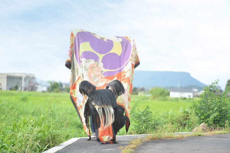
![【香川県指定民俗文化財】白鳥神社の虎獅子『虎頭の舞』 – [Kagawa] The Tiger Dance of Shirotori shrine](https://yousakana.jp/wp-content/uploads/2021/10/Lion-Dance-of-Shirotori-shrine-800x533.jpeg)
![【徳島】鬼滅のufotableが歴史的建造物「旧みずほ銀行徳島支店」を取得 – [Tokushima] ufotable, the studio behind *Demon Slayer*, has acquired the historic building ‘Former Mizuho Bank Tokushima Branch’](https://yousakana.jp/wp-content/uploads/2026/05/ufotable_tokushima-1-800x533.jpg)
![【香川】四国唯一現存、日本国内最古の水車場「高原製粉精米水車場」 – [Kagawa] “Takahara Water Mill”, the oldest water mill in Japan, the only existing water mill in Shikoku](https://yousakana.jp/wp-content/uploads/2018/09/takahara-water-wheel-800x534.jpg)
![【愛媛】宇和島の牛鬼。秋祭り – [Ehime] Autumn festival at Uwajima city, Ehime pref.](https://yousakana.jp/wp-content/uploads/2019/10/Ushioni_Uwajima.jpg)
![【香川 8/4-5】 年に2日だけ渡れる神の島『津嶋神社』 – [Kagawa 4-5 Aug.] Tsushima Shrine, an island of God that can be crossed only two days a year.](https://yousakana.jp/wp-content/uploads/2023/08/tsushima-shrine_kagawa-800x533.jpeg)

![【国指定史跡】高松の古墳の特徴はキャンディー型『石清尾山古墳群』 – [National Historic Site] Iwaseoyama kofun Tumulus Cluster](https://yousakana.jp/wp-content/uploads/2020/07/iwaseo-kofun-1-800x533.jpg)
![【香川】仏生山温泉 天平湯 – [Kagawa] Busshozan hot spring](https://yousakana.jp/wp-content/uploads/2013/07/busshozan-onsen-ice-800x536.jpg)
![【香川 8/13-15】万灯みたままつり 讃岐宮 護国神社 – [Kagawa 13-15 Aug.] Manto-Mitama Festival, Sanukigu Gokoku Shrine](https://yousakana.jp/wp-content/uploads/2023/08/panorama_gokoku-shrine_mitama-fes_zentsuji-800x533.jpeg)
![【香川】王墓山古墳(おうはかやまこふん) – [Kagawa] Ohakayama burial mound](https://yousakana.jp/wp-content/uploads/2022/04/Ohakayama-burial-mound-02-800x533.jpg)

![【閉店】創業60年の老舗のうどん屋「谷川製麺所」が閉店 – [Close Dec. 30th] Tanigawa noodle‐making factory at Kagawa](https://yousakana.jp/wp-content/uploads/2014/12/shippoku-udon-800x534.jpg)
![【香川】酵母と食べ事『ジャンキーノンキー』 – [Kagawa] breads and meals yeast based on wheat flour “Junky Nonky”](https://yousakana.jp/wp-content/uploads/2023/07/junky-nonky-01-800x533.jpeg)
![【香川 2/8】「タコ」ではなく「イカ」と呼ばれる津田の凧揚げ – [Kagawa Feb. 8] Kite flying in Tsuda, known as ‘squid’ rather than ‘octopus’.](https://yousakana.jp/wp-content/uploads/2024/02/ika_kite-flying_tsuda-matsubara-800x533.jpeg)
![【香川】約1万5千株のハナショウブ『亀鶴公園』 – [Kagawa] Kikaku park, 15,000 Japanese iris](https://yousakana.jp/wp-content/uploads/2024/06/iris-kikaku-park-800x533.jpeg)
![【香川】国の史跡、四国最大級の古墳『富田茶臼山古墳』 – [Kagawa, National historic site] Tomida Chausuyama Ancient Tomb](https://yousakana.jp/wp-content/uploads/2021/01/Tomitachausuyama-kofun_title-800x533.jpg)
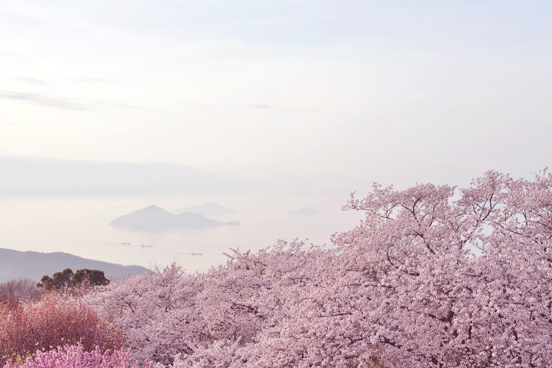
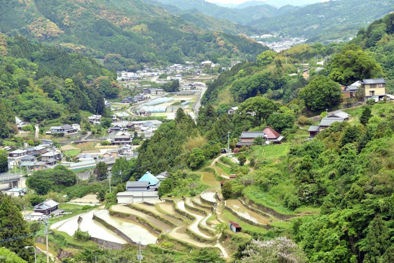
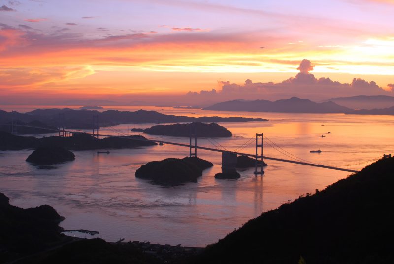
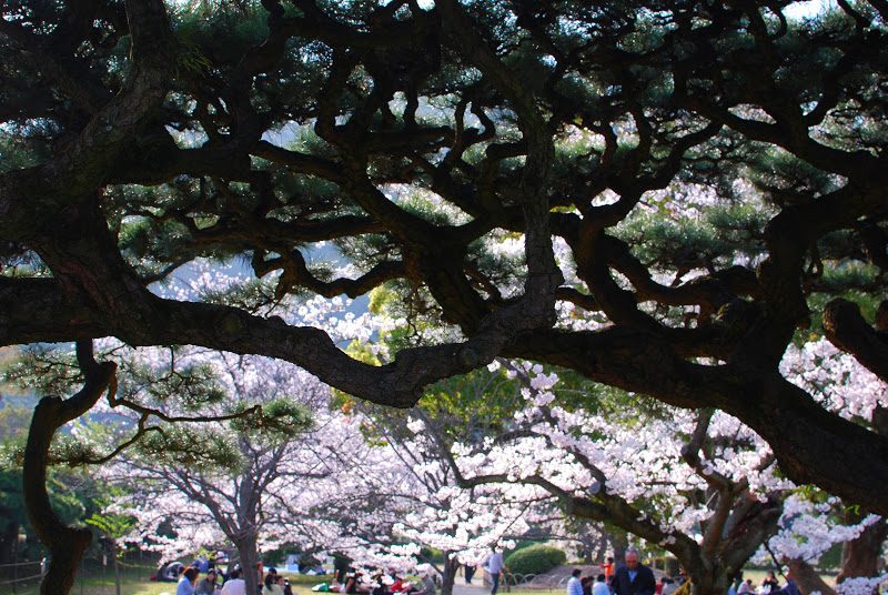
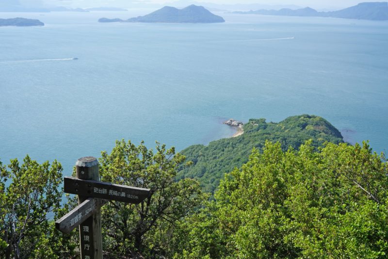
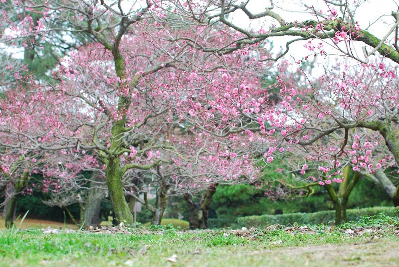
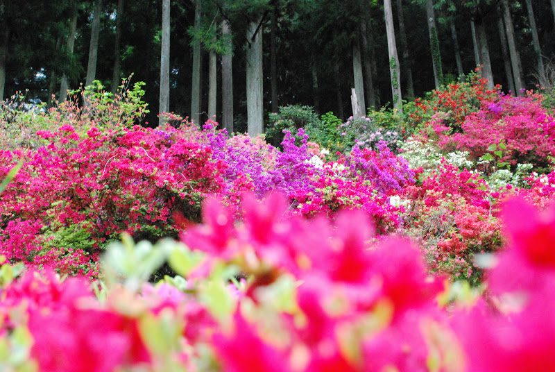
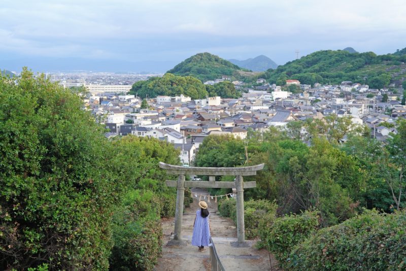
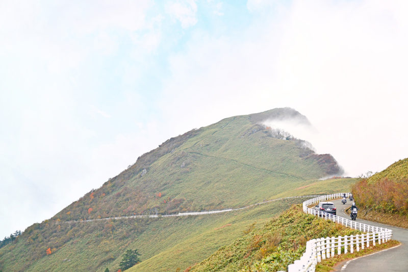
紫雲出山(しうでやま)は、香川県三豊市・荘内半島に位置する標高352メートルの山で、瀬戸内海の多島美を一望できる桜の名所です。春には山頂一帯に桜が咲き誇り、海と島々を背景にした風景は国内外から高く評価され、海外メディアでも「日本で最も美しい花見の場所の一つ」として紹介されています。
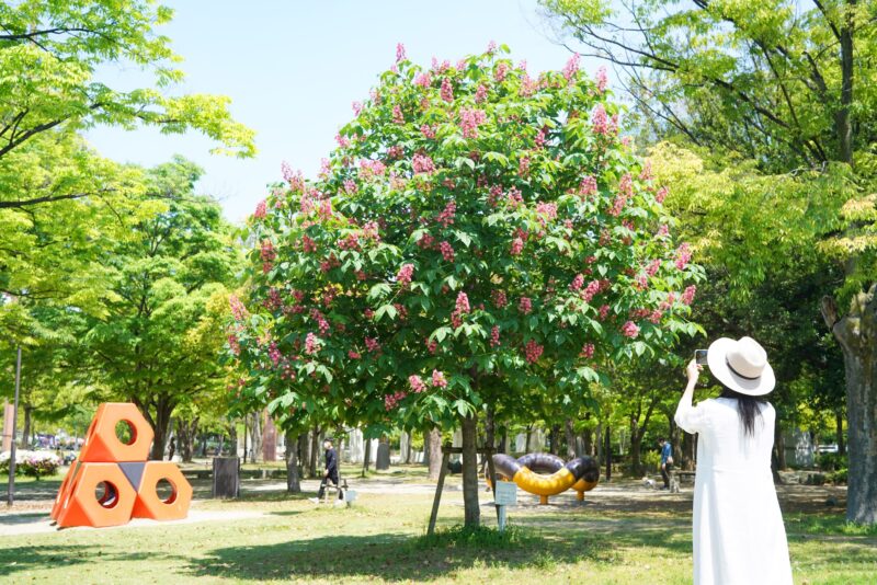
この場所の魅力は、単なる絶景にとどまりません。花や海の風景だけでなく、それを見つめる人々の姿もまた印象的で、訪れる人それぞれの時間やまなざしが重なり、豊かな体験を生み出しています。
また、山頂には弥生時代の高地性集落である紫雲出山遺跡があり、瀬戸内海の航路を見渡す重要な拠点として栄えた歴史を持ちます。こうした歴史と自然が重なり合う場所であることも、この地の奥行きを深めています。
近年は人気の高まりにより、春の花見シーズンには入山規制が行われ、予約制での観覧が導入されています。これは混雑を避け、自然環境と景観を守るための取り組みです。瀬戸内の穏やかな海と桜、そして人々の営みが重なり合う紫雲出山は、風景そのものだけでなく、そこで過ごす時間や記憶までもが心に残る特別な場所です。
Mount Shiude, a 352-metre-high mountain situated on the Shōnai Peninsula in Mitoyo City, Kagawa Prefecture, is a renowned cherry blossom spot offering panoramic views of the Seto Inland Sea’s archipelago. In spring, the summit area is ablaze with cherry blossoms, and the scenery, with the sea and islands as a backdrop, is highly acclaimed both domestically and internationally; it has even been featured in overseas media as ‘one of the most beautiful places for cherry blossom viewing in Japan’.
The appeal of this place extends far beyond the mere spectacle of the scenery. It is not only the flowers and the sea that are striking, but also the sight of the people gazing upon them; the overlapping moments and perspectives of each visitor create a rich and profound experience.
Furthermore, at the summit lies the Shiudeyama archaeological site, a highland settlement dating back to the Yayoi period, which flourished as a key strategic point overlooking the shipping routes of the Seto Inland Sea. The fact that this is a place where history and nature intertwine adds a further layer of depth to the area.
In recent years, due to growing popularity, access restrictions have been introduced during the spring cherry blossom season, with viewing now available by reservation only. This measure is designed to prevent overcrowding and protect the natural environment and landscape. Mount Shionode, where the tranquil waters of the Seto Inland Sea, the cherry blossoms and the daily lives of the people converge, is a special place where not only the scenery itself, but also the time spent there and the memories created, remain etched in the heart.
紫雲出山(しうでやま)山頂展望台
香川県三豊市詫間町箱 詫間町大浜乙451-1 [Google Map]
Observation deck of Mt. Shiude
451-1 Ohama, Takuma town, Mitoyo city, Kagawa pref., Japan [Google Map]


肩ぐるまして、子どもも撮影


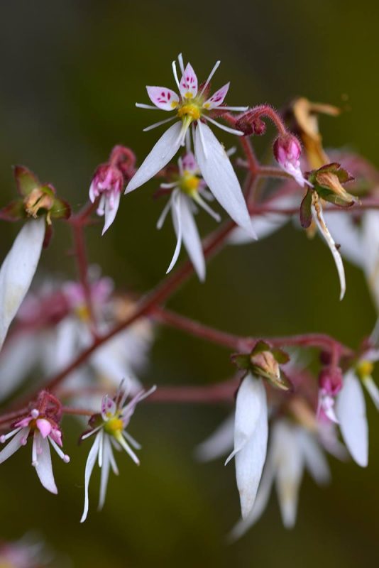
ハナニラ(Spring star)。
葉っぱにニラやネギのような匂いがあるのでこの名前がついています。

お花見

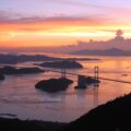
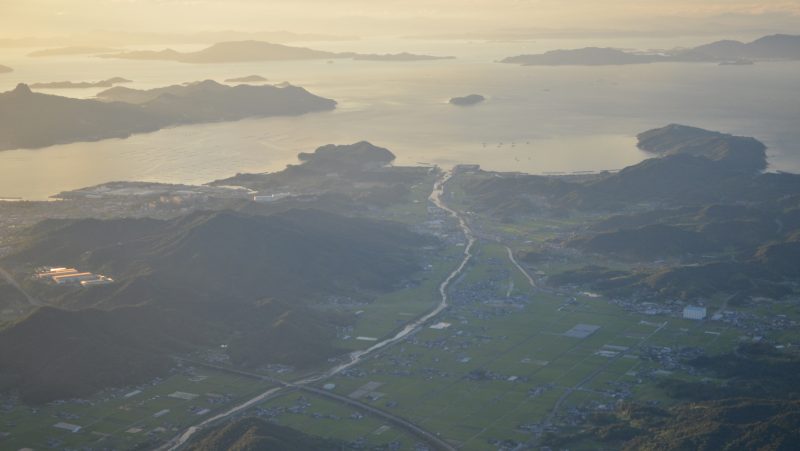
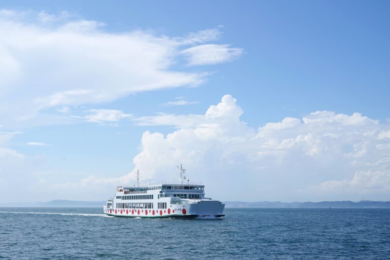
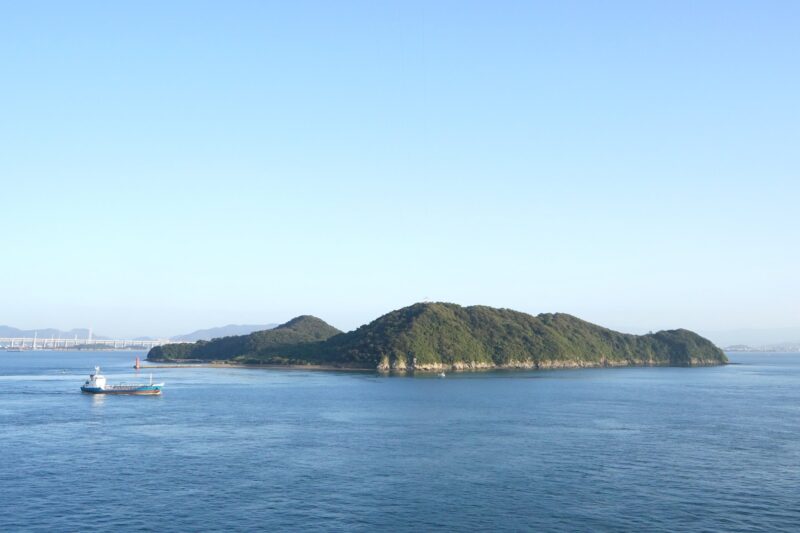
幻想的な伊吹島。夏になると、うどんダシに欠かせない「いりこ」の漁で賑わう島です。


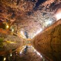
桜


紫雲出山遺跡(しうでやまいせき)は、香川県三豊市詫間町に所在する弥生時代中期後半の高地性集落遺跡である。
本遺跡は、燧灘(ひうちなだ)に突出する岬上の先端にそびえる標高352メートルの紫雲出山山頂にあり、絶好の視野と眺望とに恵まれている。
本遺跡の出土遺物の種類は、普通の集落跡における一通りのものがそろっており、その点では特殊性は認められない。従って、紫雲出山遺跡は、防砦・見張台・烽台(のろしだい)というようなもののみによって成り立っている特殊な遺跡ではなく、軍事的・防御的性格を帯びた集落遺跡と考えられる。また、畿内と密接な関係を保ちながら内海航路の監視の重要な拠点であった可能性も考えられる。
本遺跡は、弥生時代中期の初めごろから始まって、出土遺物の量から判断して、中期も終わりに近づくにつれて集落の規模が拡大し、人口も増加したらしいが、中期をもって終わっている。政治・社会の変革は、もはや不便な山頂に居住することを必要としなくなったのであろう。そして、本遺跡の東南約2キロメートルの低地に後身の船越集落が出来ている。
本遺跡から出土の石の矢尻や剣先が豊富な事実と矢尻の重さから、弥生時代に戦いがあったと佐原は考えた。
1947年(昭和22年)4月、山頂での造園植樹中に土器が出土したのが遺跡発見の端緒となった。1955年(昭和30年)12月、小林行雄が調査することになった。1957年(昭和32年)8月までに第3次調査が行われ、中期前半の土器・貝輪・鹿角製結合式釣針・獣魚骨を含む大型二枚貝・サザエを主体とする貝塚が出土している。また、1988年(昭和63年)8月、資料館建設に伴う発掘調査で、2.8×3.2メートルの円形竪穴住居址一基、一辺2.5メートル、一間四方の高床倉庫一基が検出された。住居跡は朝鮮半島の松菊里との関係が注目される。

売り上げランキング: 1,078
中央公論新社
売り上げランキング: 74,814
More from my site
![【香川】玉手箱の紫煙のよう。紫雲出山の紫陽花 – [Kagawa] Hydrangeas of Mt. Shiudeyama](https://yousakana.jp/wp-content/uploads/2019/06/Hydrangea-Mt-Shiudeyama-150x150.jpg) 【香川】玉手箱の紫煙のよう。紫雲出山の紫陽花 – [Kagawa] Hydrangeas of Mt. Shiudeyama
【香川】玉手箱の紫煙のよう。紫雲出山の紫陽花 – [Kagawa] Hydrangeas of Mt. Shiudeyama![【香川】讃岐ラーメンはまんど「はまんど」 – [Kagawa] Sanuki Ramen Hamando ‘Hamando’](https://yousakana.jp/wp-content/uploads/2026/05/hamando_ramen_iriko_kagawa-150x150.jpg) 【香川】讃岐ラーメンはまんど「はまんど」 – [Kagawa] Sanuki Ramen Hamando ‘Hamando’
【香川】讃岐ラーメンはまんど「はまんど」 – [Kagawa] Sanuki Ramen Hamando ‘Hamando’![【香川】浦島伝説が残る荘内半島の花畑『フラワーパーク浦島』 – [Kagawa] Flower park Urashima](https://yousakana.jp/wp-content/uploads/2025/05/urashima-flower-park-150x150.jpg) 【香川】浦島伝説が残る荘内半島の花畑『フラワーパーク浦島』 – [Kagawa] Flower park Urashima
【香川】浦島伝説が残る荘内半島の花畑『フラワーパーク浦島』 – [Kagawa] Flower park Urashima![【香川】一生に一度は行きたい『こんぴらさん』長い石段を登ってお参り – [Kagawa] “Kotohiragu shrine (Konpirasan)”](https://yousakana.jp/wp-content/uploads/2017/04/konpira-sakura-150x150.jpg) 【香川】一生に一度は行きたい『こんぴらさん』長い石段を登ってお参り – [Kagawa] “Kotohiragu shrine (Konpirasan)”
【香川】一生に一度は行きたい『こんぴらさん』長い石段を登ってお参り – [Kagawa] “Kotohiragu shrine (Konpirasan)”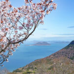 屋島で出会う春景色。瀬戸内海と桜が織りなす絶景散歩 – Spring scenery on Yashima: a stroll through the breathtaking views created by the Seto Inland Sea and cherry blossoms
![【香川】大名庭園 栗林公園、春のライトアップ – [Kagawa] Night Cherry blossoms at Ritsurin Garden](https://yousakana.jp/wp-content/uploads/2024/03/Night-Cherry-blossoms-at-Ritsurin-Garden_title-2048x1366-1-150x150.jpg) 【香川】大名庭園 栗林公園、春のライトアップ – [Kagawa] Night Cherry blossoms at Ritsurin Garden
【香川】大名庭園 栗林公園、春のライトアップ – [Kagawa] Night Cherry blossoms at Ritsurin Garden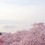 四国・瀬戸内の絶景の桜まとめ – Beautiful cherry trees of Shikoku and Setouchi islands
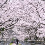 香川・桜のトンネル『竜桜(りゅうおう)公園』 – “Ryuo Park” Tunnel of cherry blossoms
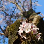 【高松で桜が開花しました】開花宣言は栗林公園から!大名庭園にある標本木。
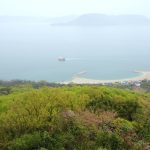 瀬戸内海の鬼ヶ島、女木島の桜 – Cherry blossoms of Megi island
コメントを残す